
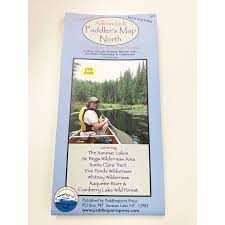
Perfect for canoe and kayak adventures, the Adirondack Paddler's Map - North (10th Edition) is your ultimate guide to exploring the Adirondack region’s waterways. This waterproof, full-color shaded relief map provides detailed, up-to-date information for outdoor enthusiasts.
Key Features:
-
Full-Color, Shaded Relief Map – Features topographic details and mountains in shaded relief, perfect for navigation.
-
Coverage Area – Includes the Saranac Lakes, St. Regis Wilderness Area, Five Ponds Wilderness, Whitney Wilderness, Raquette River, and Cranberry Lake Wild Forest.
-
Updated Portages & Campsites – Detailed portages, trails, and numbered campsites, ensuring you have the most current info for your journey.
-
Waterproof & Durable – Designed to withstand tough conditions and provide reliable navigation, rain or shine.
-
UTM Grids – For precise location tracking and map navigation.
-
Scale – 1:50,000 scale for accurate, easy-to-read mapping.
Whether you’re a seasoned paddler or a beginner, this map will enhance your experience in the Adirondack wilderness. Perfect for both day trips and extended adventures, the Adirondack Paddler's Map ensures you stay on course and enjoy every moment of your outdoor adventure!